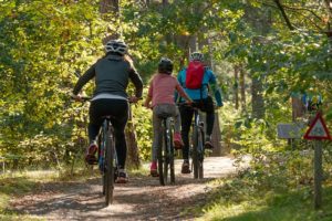
Bike sales went through the roof during the COVID-19 pandemic. So much so, that many stores had waiting lists for eager bicyclists. The surplus of time, plus the need to get out with nowhere in particular to go, resulted in this boom. This persuaded cities to improve their “bike-ability” – Richmond included.
Allen & Allen is happy to present the Bike Lane Lowdown, a series of posts meant to inform and update Richmonders on bike lanes in our area. Whether we’re listing new openings, or sharing warnings about problematic intersections, we will be your go-to resource.
Bicycling is the best of every possible world: it’s family-friendly, healthy, socially distant, reduces pollution in the environment, and if you follow the correct protocols, safe. This is where we are happy to come in.

As the country pushes to become more cyclist-friendly, city planners should create safe and well-thought-out paths and procedures. We will detail some issues in later posts, but for the time being, we’d like to list out where Richmond currently built bike lanes, and where future installations are taking place.
According to pedestrian, bicycling, and trail updates from Richmond’s Department of Public Works, 17 projects and 32 miles of bike lanes have been completed.
New bike lanes in Richmond
- 17th Street (South) – two-way cycletrack Dock Street to Franklin Street (East)
- 29th Street from Libby Terrace to Kane Street
- Brook Road from Azalea Avenue to Charity Street
- Dock Street – Pear Street to Main Street (East)
- Floyd Avenue – the City’s first bike-boulevard – Thompson Street (North) to
- Laurel Street (North)
- Franklin Street from 14th Street to 18th Street
- Franklin Street (West to East) – floating parking lanes Belvidere Street (North) to 9th Street (North)
- Grayland Avenue – Addison Street (South) to Harrison Street (South)
- Lee Bridge – buffered bike lanes
- Leigh Street (West) – buffered bike lanes Dinneen Street to Myers Street
- Lombardy Street – Broad Street (West) to Brook Road (South)
- Main Street (East) – Williamsburg Road to Nicholson Street
- Malvern Avenue – Fitzhugh Avenue to Cary Street
- Manchester Bridge – buffered bike lanes
- North Avenue – Laburnum Avenue (West) to Chamberlayne Avenue
- Patterson Avenue from Commonwealth Avenue to Thompson Street
- Semmes Avenue – Forest Hill Avenue to Cowardin Avenue (North & South)
Further, seven more projects are set to be completed soon, with two already underway.
Up-and-coming bike lanes in Richmond
- Forest Hill Avenue from Powhite Parkway to Hathaway Road (under construction)
- Jahnke Road from Blakemore Road to Forest Hill Avenue (under construction)
- Bank Street from 9th Street to 14th Street
- Government Road from Williamsburg Avenue to 36th Street
- Nine Mile Road from 25th Street to I-64
- Westover Hills Boulevard from Boulevard Bridge to Forest Hill Avenue
- Williamsburg Avenue from Stoney Run Drive to Northampton Street
As it stands, safety protocols leave a lot to be desired. These new projects may become dauntingly complicated for cyclists and drivers alike. How many people must get hurt before the city takes responsibility and makes changes to its infrastructure? How can we as residents clarify the confusion concerning these new thoroughfares? We’ll break some of these points down in our upcoming posts for the Bike Lane Lowdown.


